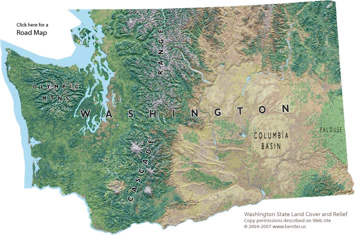
Washington State map
Shaded relief map with land cover

Map Sources: Washington Gap Project 1991 Land Cover for
Washington State, USGS shaded relief map of Washington
Permission to copy map in printed paper form is granted for educational
use.
» How to request permission to republish online.
View large version Washington map (pdf) or the previous map version.
Cartography by Fred Bentler
» Washington State maps collection
» Eastern Washington
maps collection
» Washington State interactive map
» Eastern Washington
animals and plants

Together, we can build a place where grass-stains, muddy boots, and climbing trees are parts of everyday life for kids.
© Copyright 2004-2023 All rights reserved